
Flow
Datadata.flowWhere rain would run: Flow is bright along streams and rivers (the area draining through each point, on a log scale), Direction is the way water flows (0..1 = 0..360°, 0° = +X), and Basins gives each drainage basin its own value. Pits fill until they spill; water leaves at the world's edges.
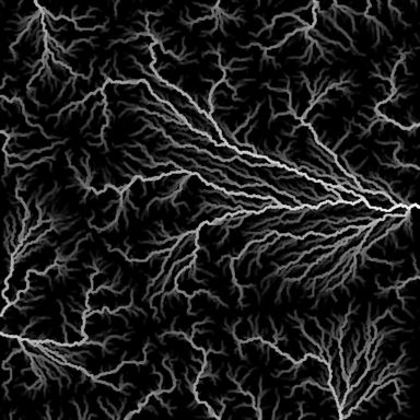
Output with default settings, rendered by LibreTerrain.
Inputs
| Port | Type | |
|---|---|---|
| Terrain | Heightfield |
Outputs
| Port | Type | |
|---|---|---|
| Flow | Mask | |
| Direction | Mask | |
| Basins | Mask |
Settings
| Setting | Default | Range / options | Description |
|---|---|---|---|
| Method | D-infinity (smooth) | D-infinity (smooth), D8 (single path) | D-infinity splits water between two downhill neighbours, so flow spreads on open slopes; D8 sends it all one way, giving sharp single-cell streams. |
| Detail size | 8 m | 1 to 1,000 m | Cell size water is routed at, in metres: about the width of the smallest streams. Smaller is slower. The result is the same at any preview or build resolution. |
See also
Aspect · Curvature · Distance · Height Mask · Occlusion · Rock Hardness · Select Range · Slope · Wetness