
Wetness
Datadata.wetnessHow damp the ground is, for placing vegetation: white where water collects (large drained area on gentle ground) and near water. Water is the Water mask if connected (e.g. a River, Lakes or Sea mask), plus streams. Water distance is black at the water, white Reach metres away.
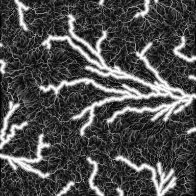
Output with default settings, rendered by LibreTerrain.
Inputs
| Port | Type | |
|---|---|---|
| Terrain | Heightfield | |
| Water | Mask | Optional |
Outputs
| Port | Type | |
|---|---|---|
| Wetness | Mask | |
| Water distance | Mask |
Settings
| Setting | Default | Range / options | Description |
|---|---|---|---|
| Reach | 150 m | 1 to 100,000 m | How far from water the ground stays damp, in metres. |
| Stream area | 0.5 km² | 0.001 to 100,000 km² | Drained area at which a stream counts as water. |
| Detail size | 8 m | 1 to 1,000 m | Cell size water is routed at, in metres: about the width of the smallest streams. Smaller is slower. The result is the same at any preview or build resolution. |
See also
Aspect · Curvature · Distance · Flow · Height Mask · Occlusion · Rock Hardness · Select Range · Slope